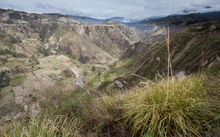
 One of the best parts about open-ended traveling is that it gives you the option to change your mind regarding the next destination at a moment’s notice. After a fantastic week studying Spanish in Quito, Kenny and I planned to leave the capital city for the relaxing hot springs of Banos, Ecuador. At the last minute, we decided on a detour to see the crater lake in the small village of Quilotoa after one night in the town of Latacunga. What was supposed to be a simple day trip turned into a three day Andean trek along the Quilotoa Loop after talking with the owner of our hostel before heading out. We literally made the decision to do the trek at 8:30 the night before we set out. This left only enough time to off-load our heavier baggage (electronics) in the hostel store room, briefly glance over the hand drawn map and oddly translated directions and catch a few winks before running off to the bus station the following morning. As the bus rolled out, my thoughts came back to our hostel owner’s words that, ‘everyone gets lost somewhere on the trail but, they all eventually find their way.’
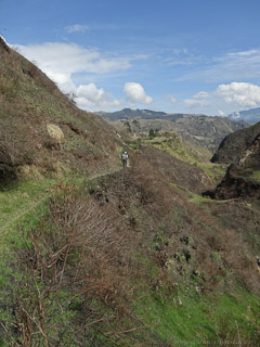 Hiking the Quilotoa Loop is a bit of a misnomer as the trail itself does not actually form a loop but rather a connect-the-dots line between a number of small villages scattered through the Andes. The loop part of the name refers to the transportation to and from the trailheads in addition to the trail itself which forms a loop through some of the most beautiful country we have seen thus far. As one could guess, you can travel the loop either clockwise or counterclockwise from the town of Latacunga although traveling the clockwise direction is by far more popular. ‘Popular’ seemed to be a relative term and though we saw the trail written about in numerous guide books, we came across only a handful of trekkers.
 The classic Quilotoa Loop is a 3-day trek and begins in the town of Quilotoa at the crater itself. From here it travels 14 km to the village of Chugchilan. Day two involves another 14 km trek between Chuchilan and Isinlivi and day 3 finishes another 10 km to the village of Sigchos. It is most common to hike the route in this direction because the trekking is much easier – particularly on day 1 in which the trail descends from an altitude of 4200 m to 3200 m to the river before climbing back up another 300 m to the sleepy town of Chugchilan. Rather than go the typical route, we chose to hike the reverse direction because a) who doesn’t like to suffer a little, and b) we thought finishing at the crater itself would be more dramatic and satisfying than vice versa.
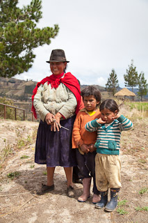
 To begin the trek, we first took a bus (~2 hours) from the town of Latacunga to the town (village) of Sigchos. From here, we began the 10 km trek up to Isinlivi. This day is said to be the ‘easy’ day as it is only a 10 km distance and does not gain too much altitude (~100 m). However, the gain refers to ‘net’ gain and ‘easy’ is relative when considering the overall elevation begins at 2,900 m (~9,500 ft). The trail descends some 400 m only to regain this plus the remaining 100 m after reaching the river. Plus, for this section of the trail, we only had the hand drawn instructions, no written notes, which meant making the occasional wrong turn was inevitable. Happily, idyllic farmhouses with friendly locals seemed to magically appear when we were lost to point out the correct direction and set us back on course (after a bit of wandering). We had two travel companions for this section of the trail, a French/German couple, with a better grasp of the Spanish language than we had (bonus). Unfortunately, we were all at a loss when it came to speaking with locals that spoke only their native Quechua language. In these cases, a lot of smiles and hand gestures seemed to do the trick and we arrived safely (if exhausted) at our first destination.
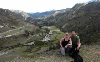
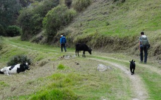 For the second day of the hike along the 14 km stretch of paths which led from Isinlivi to Chugchilan, we traded companions for a German and a local dog we dubbed ‘Matilda.’ At first, we were concerned someone had lost their dog as she persisted to follow us down the trail. However, we later learned Matilda’s self-appointed job was to travel with hikers along the trail between the crater and Isinlivi and we were more than happy to be her adopted pack over the following couple of days. The hike this day was by far the most beautiful and meandered through the mountains, into valleys, along a river and through several untouched Quechua villages.
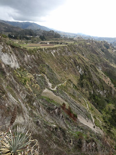 Day three, referred to as the ‘hard day,’ began from the village of Chugchilan at an elevation of 3180 m (~10,400 ft) and immediately descended 300 m back down to the river before beginning the 1000 m ascent to the crater itself. The climb was done in 3 stages: 1- the 400 m steep climb back out of the river valley, 2- a gradual 200 m climb to the base of the crater and 3- the 400 m switchbacks to the crater rim itself. Maybe it was because we were more mentally prepared for the pain that this part of the trail promised, but it didn’t seem all that bad. Oddly for me, the first day (the one which was supposed to be the easiest) was by far the most difficult.
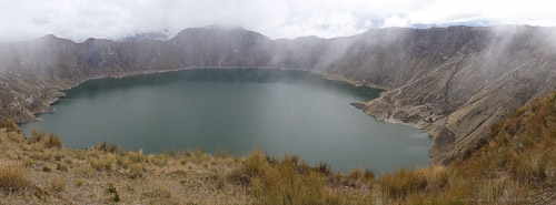
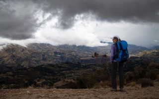 After finally reaching the crater, the view was definitely worth our choice of direction and was absolutely breathtaking. The crater itself has a 2 mile diameter and contains a beautiful, blue lagoon. We stayed to take pictures here until thick storm clouds poured in filling the entire crater. From this point on, we only had momentary peeks of the lagoon 400 m below through the mist. The last part of the hike was along the crater rim itself at 3914 m in elevation (~12,800 ft), which proved to be far more difficult than we had imagined, and was mentally the toughest part of the hike for both Kenny and I. The downpour which began halfway along our rim trek only served to add to our exhaustion. After finally arriving in the village of Quilotoa, we ran for the first cover we could find which happened to be at the door of El Conejito, our de facto hostel for the night. After negotiating a price and moving into our room, we immediately fell asleep for the next two and a half hours. We awoke as the rainstorm passed and in time to see the magic light just before sunset over the crater itself.
 Each night after completing the day’s trek, Kenny and I both questioned whether or not our legs would hold out for the following day. Somehow, we managed to push through and the experience proved to be one of the highlights of our travels thus far. Following the trek, we returned by bus to Latacunga and continued further south to the initially planned destination of Banos, Ecuador having earned the right to soak our tired muscles in the steamy, thermal pools at the foot of the Tungurahua volcano.

Wow! You guys are still my heros! Enjoy reading about all of your experiences thus far! Take care!
Yeah, sorry about the frequency though. It has been difficult to make time for writing as often as we want and Laura has had better luck at finishing posts she starts. Thanks for reading, Shari.
Matilda is the bomb!
Dan, I couldn’t agree more! She was an awesome trekking dog.
Reverse hike – I like it! How was the bus ride? And how are you meeting the people you go on your excursions with? Just curious. Have FUN!
Hey Mike! We have been really fortunate with long distance bus trips so far. Much more comfortable that we expected. As for meeting people, for this hike in particular, the first couple we traveled with was on our same bus from Latacunga to Sigchos. After this we met other people at our hostel the first night that happened to be going our direction. In general, the hostels are where we most frequently find adventure companions. Oddly enough, some of them turn up again weeks down the road which is really fun too!